Bienvenue au Laboratoire d'Optique Atmosphérique
Le Laboratoire d’Optique Atmosphérique (LOA) est une Unité Mixte de Recherche CNRS/Université de Lille, situé sur le campus Cité Scientifique de Villeneuve d’Ascq. Ses recherches fondamentales portent sur la physique de l’atmosphère, en particulier l’étude du rayonnement, des nuages, des aérosols, et de certains gaz.
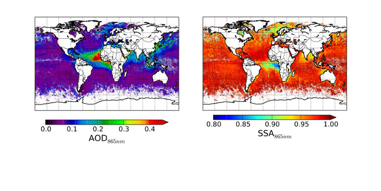
Distribution globale de l'absorption des aérosols (SSA)
pour la première fois inversée dans le proche-infrarouge (POLDER) et concentration associée (AOD)
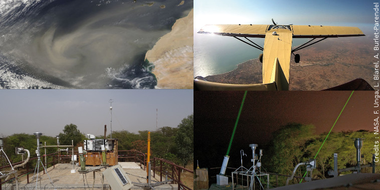
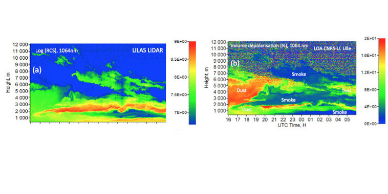
Poussières désertiques et feux de biomasse au Sénégal
Toutes les informations sur la campagne de mesures SHADOW-2
Un évènement atmosphérique d’ampleur inédite
... observé mi-octobre 2017 en région Hauts-de-France
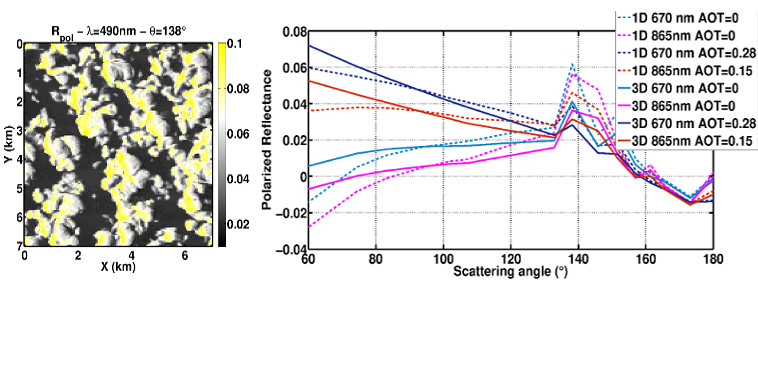
Effets des hétérogénéités nuageuses sur les luminances polarisées
L’épaisseur optique aérosols au dessus des nuages peut être impactée contrairement au rayon effectif du nuage
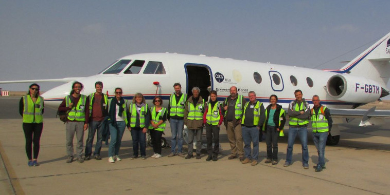
Premiers résultats de la campagne de mesures AEROCLO-SA
qui s'est déroulée en Namibie du 22 août au 12 septembre 2017
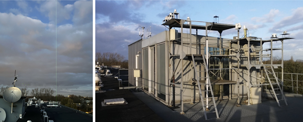
Notre plateforme ATOLL a obtenu le label ACTRIS-ERIC
C’est une étape majeure pour la recherche atmosphérique en France. Le 8 décembre dernier à Bonn, l’infrastructure européenne ACTRIS ERIC a officiellement labellisé six premières plateformes de pointe, dont trois sites français.
Ce label, fruit d'un processus d'évaluation rigoureux, récompense l'expertise de :
- ATOLL (Lille) : Labellisé pour la télédétection des aérosols.
- CO-PDD (Cézeaux/Opme/Puy de Dôme) : Également distingué pour la télédétection des aérosols.
- OPAR (La Réunion) : Labellisé pour la télédétection des gaz traces réactifs.
- Données de haute qualité : Des mesures harmonisées et fiables sur le long terme pour mieux comprendre le changement climatique et la qualité de l'air.
- Accessibilité mondiale : Un accès ouvert à des équipements de pointe pour les chercheurs internationaux via le Centre de Données ACTRIS.
- Coopération européenne : Un renforcement du leadership scientifique français au sein des enjeux environnementaux mondiaux.
The 2022 Hunga plume – first month post-eruption
Asher, E., Legras B., Boichu, M. , Bruckert J., Podglajen A., Ghassa T. et al.
Atmospheric transport and evolution of Hunga water vapour and aerosols
Khaykin, S., A. Bourassa, V. Aquila, A. Baron, L. Rieger, A., Rozanov, R. Ueyama, Boichu, M. et al.
FLARE-GMM: an automatic aerosol typing model based on Mie–Raman–fluorescence lidar measurements with LILAS
Miri, R., Pujol, O., Hu, Q., Goloub, P., Veselovskii, I., Podvin, T., and Ducos, F.
Villeneuve d'Ascq (alt. 60m)
- Température
- 7.3° C
- Pression abs.
- 1025.2 hPa
Mis à jour le 7 avr. 2026, 3h35 TUC